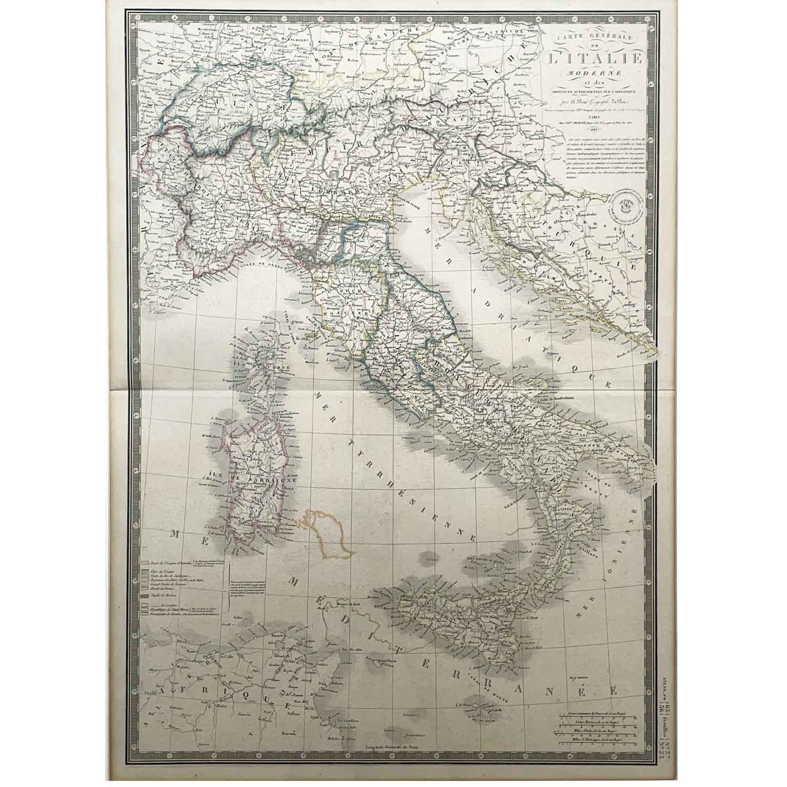
Adrien Brué Geographical Map of Italy 1842 with a central horizontal fold, colored according to the administrative boundaries legend. Top right: Carte Generale de L’Italie Moderne et des Provinces Autrichiennes sur l’Adriatique by A. Brué Geographe du Roy Paris 1842. Below, a circular dry stamp mentions the acquisition by Ch. Piquet. The sheet is in good condition apart from irregular coloring in the southern part of Corsica.
Height: 51 (75.5) cm. - Width: 36 (60.5) cm. - Depth: 2 cm.
art. A1033